01
Erosion intelligence
Daily soil-loss modeling, without the black box.
RUSLE2-aligned management simulation combines local soil, terrain, erosivity, vegetation, residue, and operations into traceable annual results.
 ContourStack
TerrainLogic beta
Bring terrain, soils, climate, management, and field history together in one auditable desktop workflow—built for conservation planners, engineers, and land managers.
01 / The platform
TerrainLogic preserves the relationships between land, management, and time. Each run can be explored as a scenario or authored into the managed field’s history for the next cycle.
Erosion intelligence
RUSLE2-aligned management simulation combines local soil, terrain, erosivity, vegetation, residue, and operations into traceable annual results.
Nutrient accounting
Track additions, crop uptake, biomass return, legume fixation, residue transformations, and carried field state in a dedicated nutrient report.
Gully risk
Map terrain-driven corridors on satellite imagery and trace contributing area beyond the field boundary.
Waterway engineering
Carry mapped flow paths into channel sizing, editable design constraints, survey tables, dig profiles, as-built comparisons, and inspection history.
Explore engineering →02 / Erosion modeling
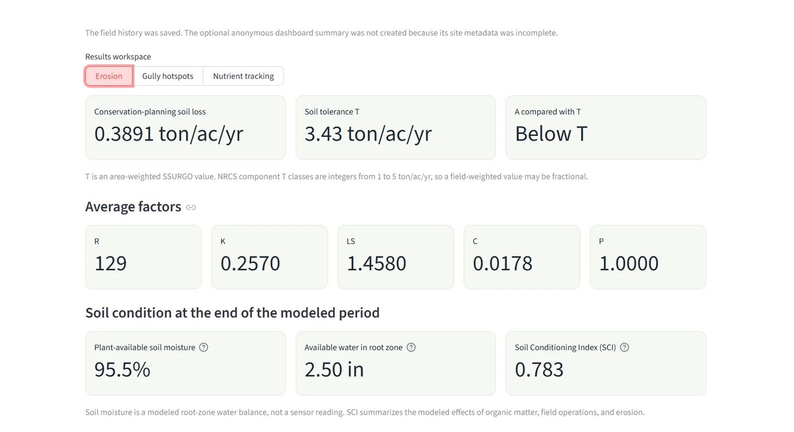
TerrainLogic resolves the field, terrain, soils, climate, and management into a daily RUSLE2-aligned simulation. The result is shown against soil tolerance T, with R, K, LS, C, P, soil moisture, and SCI available for review.
03 / Nutrient tracking
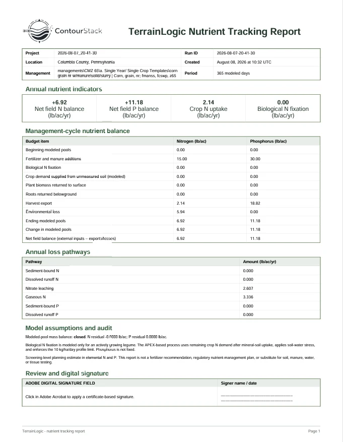
The nutrient workspace follows fertilizer and manure additions, crop uptake and harvest export, biomass and roots returned to soil, legume fixation, environmental pathways, and carried field state from the beginning to the end of the cycle.
04 / Field workflow
Use authoritative local and public data where possible. Add professional judgment where it matters. Keep the evidence attached to the field.
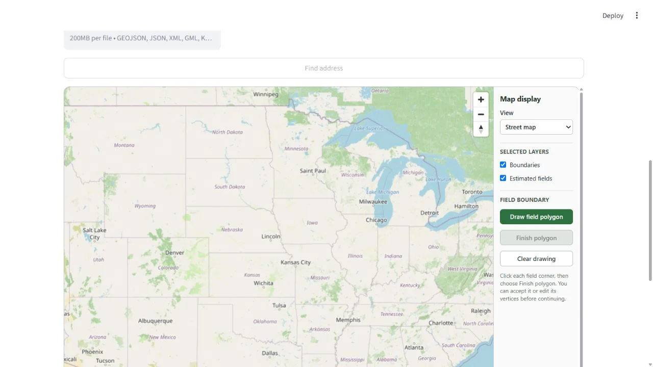
Draw a field or select an estimated boundary. TerrainLogic resolves county, climate, soils, elevation, slope, and flow context.
Select or author exact management operations. Run a new scenario or continue the field’s managed state.
Review erosion, soil condition, moisture, nutrients, gully risk, and supporting daily evidence.
Generate separate erosion, nutrient, and engineering reports; save the run to field history when it becomes the plan.
05 / Engineering workspace
TerrainLogic carries terrain-derived flow information from the field map into a transparent preliminary grassed-waterway workflow. Mapped geometry supplies context; the responsible professional still selects and documents the governing engineering inputs.
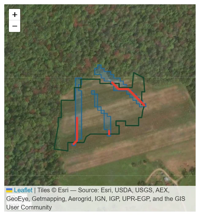
Potential corridors are shown on satellite imagery with total and in-field contributing area, corridor slope, severity, and DEM-coverage checks.
Field-to-design handoff
Reach length, contributing area, design grade, local rainfall context, soil erodibility, and vegetation choices are assembled in one workspace. Peak discharge remains editable and its source is recorded so a documented EFH-2, WinTR-55, NETS, or state-approved value can control the design.
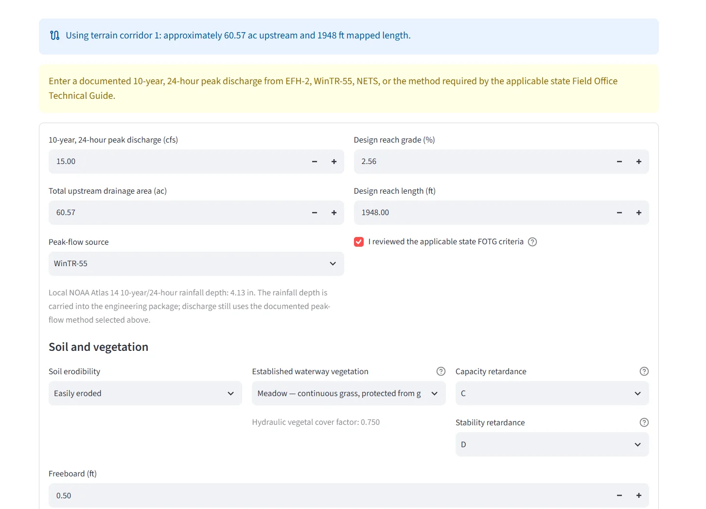
Field-derived values arrive prefilled while the designer can review, replace, and recalculate the governing inputs.
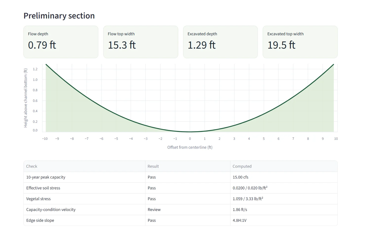
See flow and excavation dimensions, inspect the cross section, and continue into centerline and edge surveys, a dig profile, engineering documents, and as-built comparison.
Terrace design
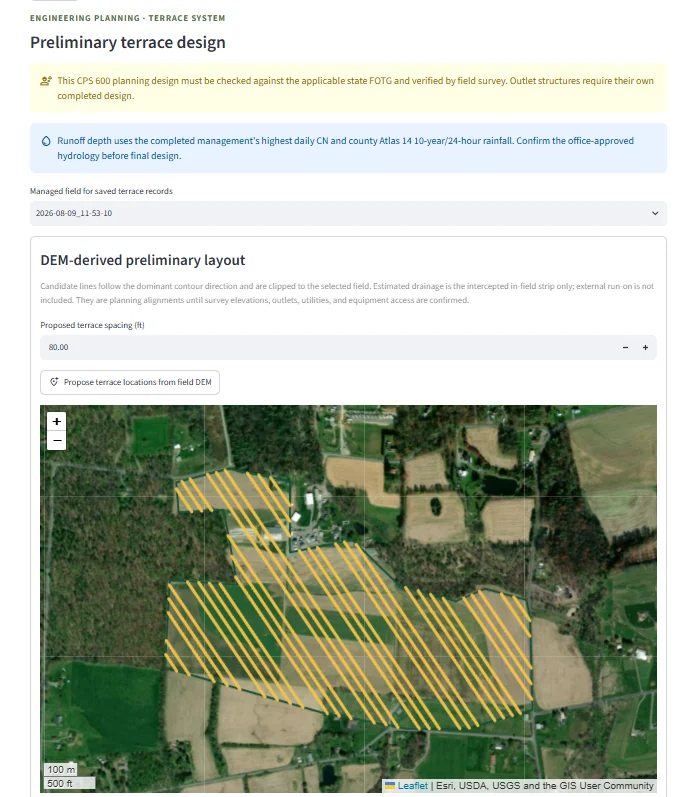
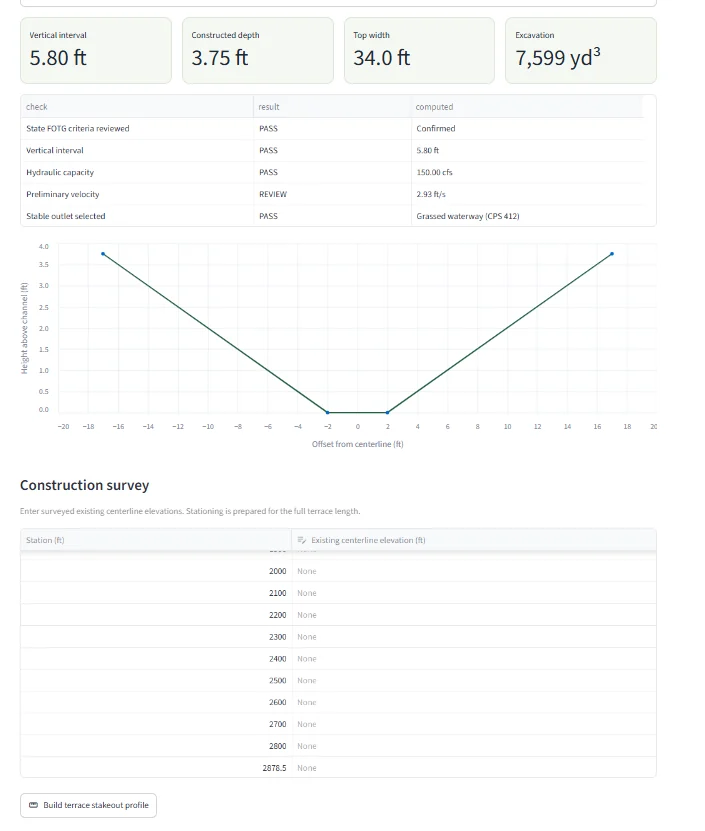
TerrainLogic can propose contour-aligned terrace locations from the selected field DEM, calculate a preliminary CPS 600 planning section, and prepare stationing for a construction survey and stakeout profile. Designs must still be checked against the applicable state FOTG and verified by field survey.
06 / Local dashboard
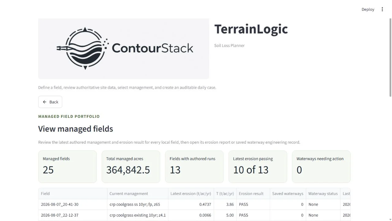
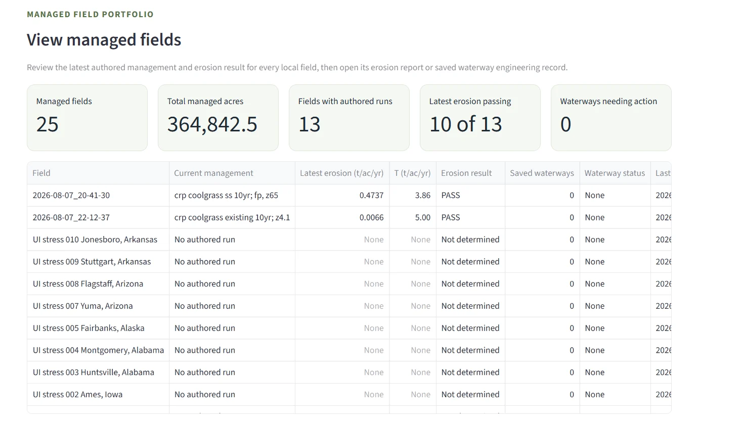
The desktop dashboard brings every locally managed field together without requiring a cloud account. Review current management, latest erosion, authored cycles, reports, saved waterways, and practices that need attention.
07 / Stateful field design
A scenario can remain a what-if. An authored run becomes field history, preserving the ending residue, biomass, water, soil-condition, and nutrient state as the starting context for the next management cycle.
08 / Watershed intelligence
ContourStack is developing a privacy-protected aggregation layer for HUC12 watersheds. Individual field boundaries and management records remain local; only qualified, anonymous summaries contribute to watershed research and monitoring.
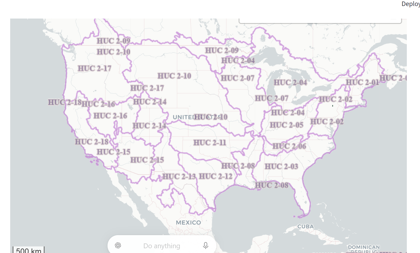
USGS watershed boundaries provide national context and progressively reveal HUC12 detail as users zoom.
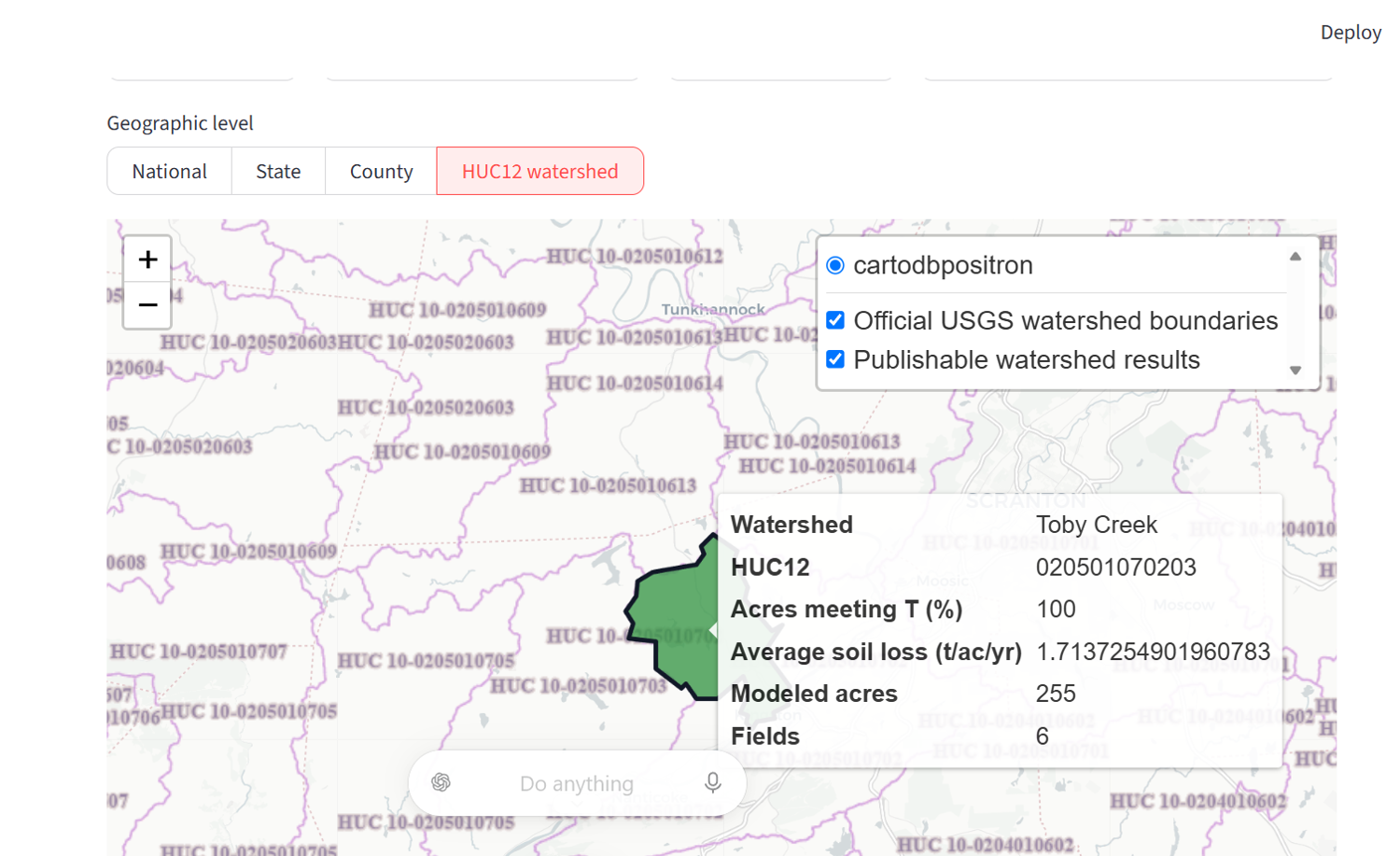
Published polygons can report modeled acres, average soil loss, acres meeting T, field count, and—when available—nitrogen and phosphorus movement.
Watershed erosion
Aggregate soil loss, acres meeting soil-loss tolerance, modeled acreage, and conservation-management coverage by HUC12 and reporting year.
Watershed nutrients
Summarize planning-level nitrogen and phosphorus movement across qualified watersheds while keeping identifiable field records out of the aggregate product.
Privacy by design
Minimum-field publication thresholds suppress small groups. Uncolored watersheds mean insufficient publishable data—not zero erosion or nutrient loss.
Planned capability: the watershed dashboard is under development and is not part of the current TerrainLogic beta. Measures will be modeled planning indicators for research and watershed monitoring, not regulatory determinations.
05 / Confidence
TerrainLogic separates equation verification, reference-model parity, and independent observational validation. See the evidence, metrics, source literature, applicability domains, and unresolved limitations on the dedicated science page.
09 / Report library
10 report typesOpen any example to see the actual TerrainLogic report format. These are generated from realistic field, management, and engineering scenarios—not marketing mockups.
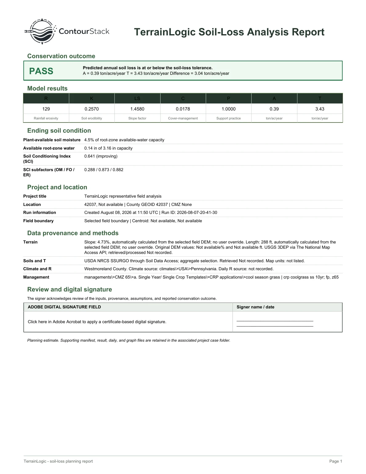
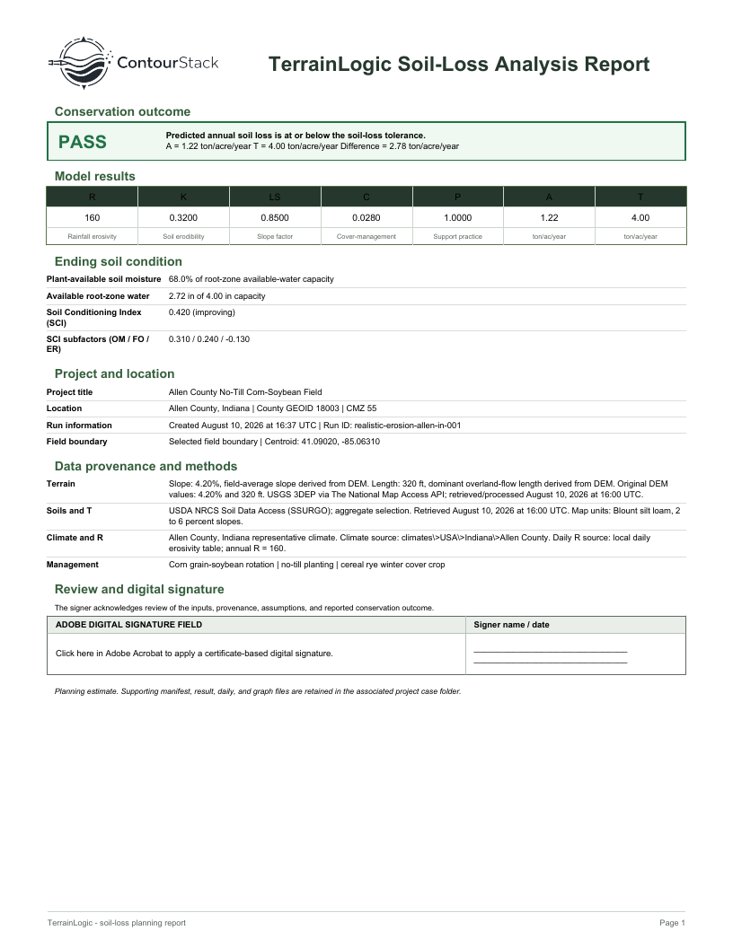 Soil-Loss Analysis ReportErosion, T, factors, soil condition, and provenance
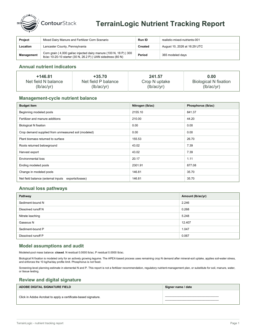 Nutrient Tracking ReportStarting and ending N and P balances and pathways
 Gully Hotspot Screening ReportNumbered satellite field map, terrain corridors, contributing area, and field checks
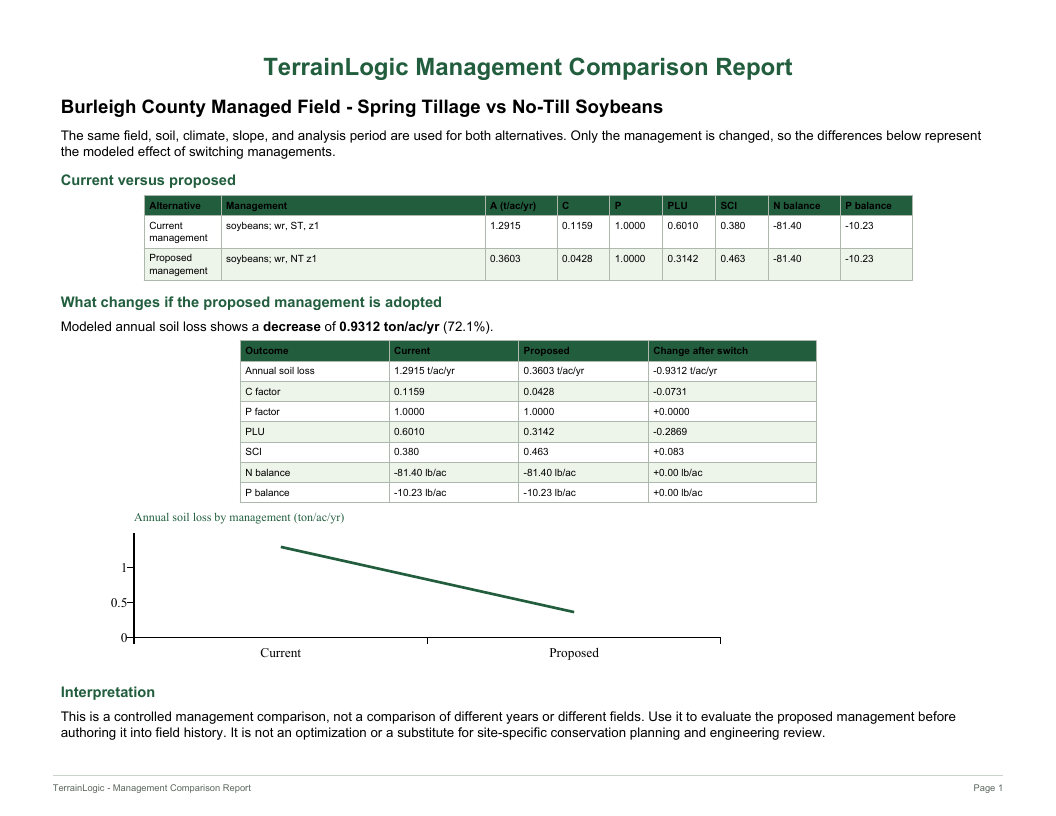 Management Comparison ReportCurrent management compared with a proposed alternative
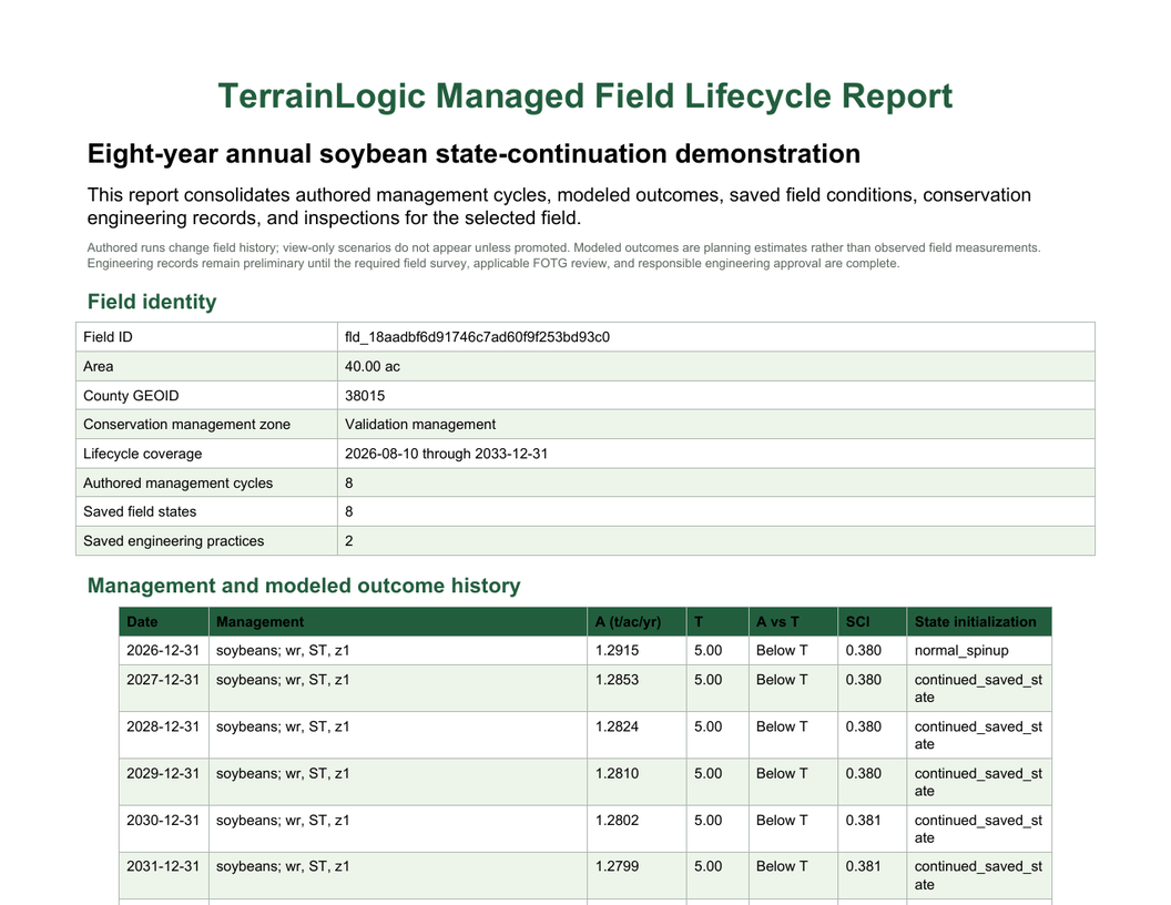 Managed Field Lifecycle ReportManagement years, field states, practices, and inspections
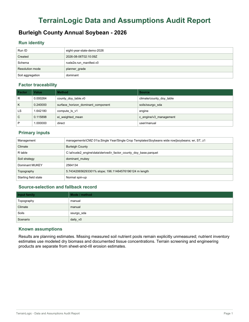 Data & Assumptions AuditInput sources, model modes, warnings, and traceability
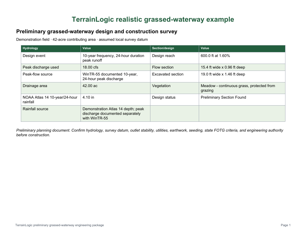 Waterway Engineering PackageDesign basis, section, checks, survey, and dig profile
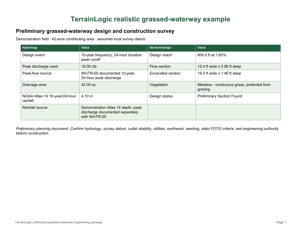 Waterway As-Built PackageDesigned versus constructed dimensions and acceptance
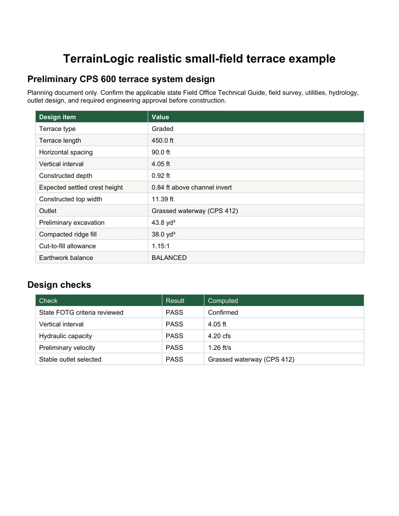 Terrace Engineering PackageLayout, hydraulic sizing, section, and stakeout survey
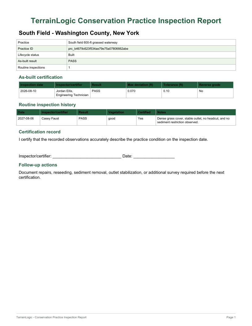 Practice Inspection ReportAs-built record, routine inspections, status, and follow-up
10 / System requirements
Low-end testedTerrainLogic does not require a workstation-class processor or a dedicated graphics card. Low-end compatibility testing covered installation, site determination, repeated erosion and nutrient runs, gully screening, waterway and terrace design, saved-field reloads, memory recovery, and clean shutdown.
Tested baseline
Minimum supported
Recommended
Observed low-end performance: four consecutive field runs completed without error. Routine analyses used approximately 215–250 MB of application memory. A more intensive terrace DEM scan briefly peaked near 600 MB and released that memory after processing. Initial startup was the principal low-end tradeoff.
For technical teams
Request a focused TerrainLogic briefing for your conservation, research, engineering, or program team. We will tailor the demonstration to the capabilities and decisions that matter to your organization.
Private beta
We’re inviting conservation professionals and land managers who want to test workflows, compare results, and help shape the next release.